


_031.jpg)
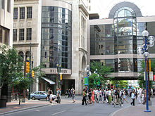
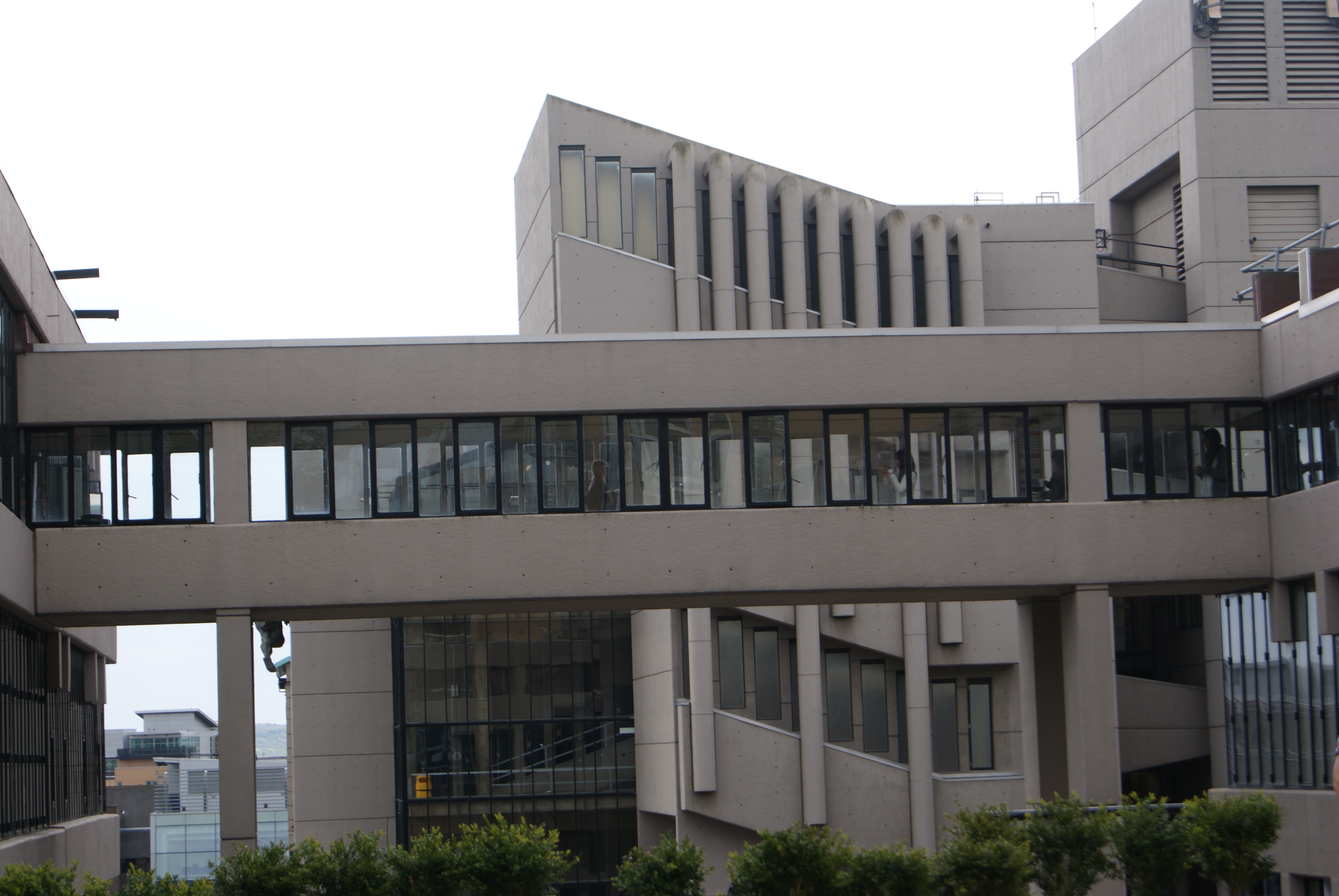
In an urban setting, a skyway, catwalk, sky bridge, or skywalk is a type of pedway consisting of an enclosed or covered bridge between two buildings. This protects pedestrians from the weather. These skyways are usually owned by businesses, and are therefore not public spaces (compare with sidewalk). Skyways usually connect on the first few floors above the ground-level floor, though they are sometimes much higher, as in Petronas Towers (though this skyway is often referred to as a sky bridge). The space in the buildings connected by skyways is often devoted to retail business, so areas around the skyway may operate as a shopping mall. Non-commercial areas with closely associated buildings, such as university campuses, can often have skyways and/or tunnels connecting buildings.
The world's largest skyway network – Calgary, Alberta's "+15 Walkway" system – has a total length of 16 km (10 miles). However, the system is discontinuous, and it does not connect every downtown building. The largest continuous network of skyways – the Minneapolis Skyway System – spans 8 miles (13 km) connecting 69 blocks in downtown Minneapolis.
Other cities in the Midwest, such as Des Moines, Cedar Rapids, Rochester, and Saint Paul also have significant skyway systems. On a smaller scale, terminals of large airports are often connected by skywalk systems, as at Manchester Airport, United Kingdom.
The Mumbai Skywalks system is a discontinuous system of 50 skywalks planned in the Mumbai Metropolitan Region, each 1 to 2 kms in length. When completed, the system will be the largest skyway system in the world. The first of these is a 1.3km (0.8mi) long skywalk connecting the suburban regions of Bandra and Kurla.[1][2][3]
Some cities have the equivalent of a skyway underground, and many locales have mixed subway/skyway systems; see underground city.
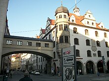
Early examples of skywalks[]
- Copenhagen, Denmark: skywalk connecting courts building to adjacent uses, 18th century
- Faaborg, Funen, Denmark: skywalk in centrum, 18th century
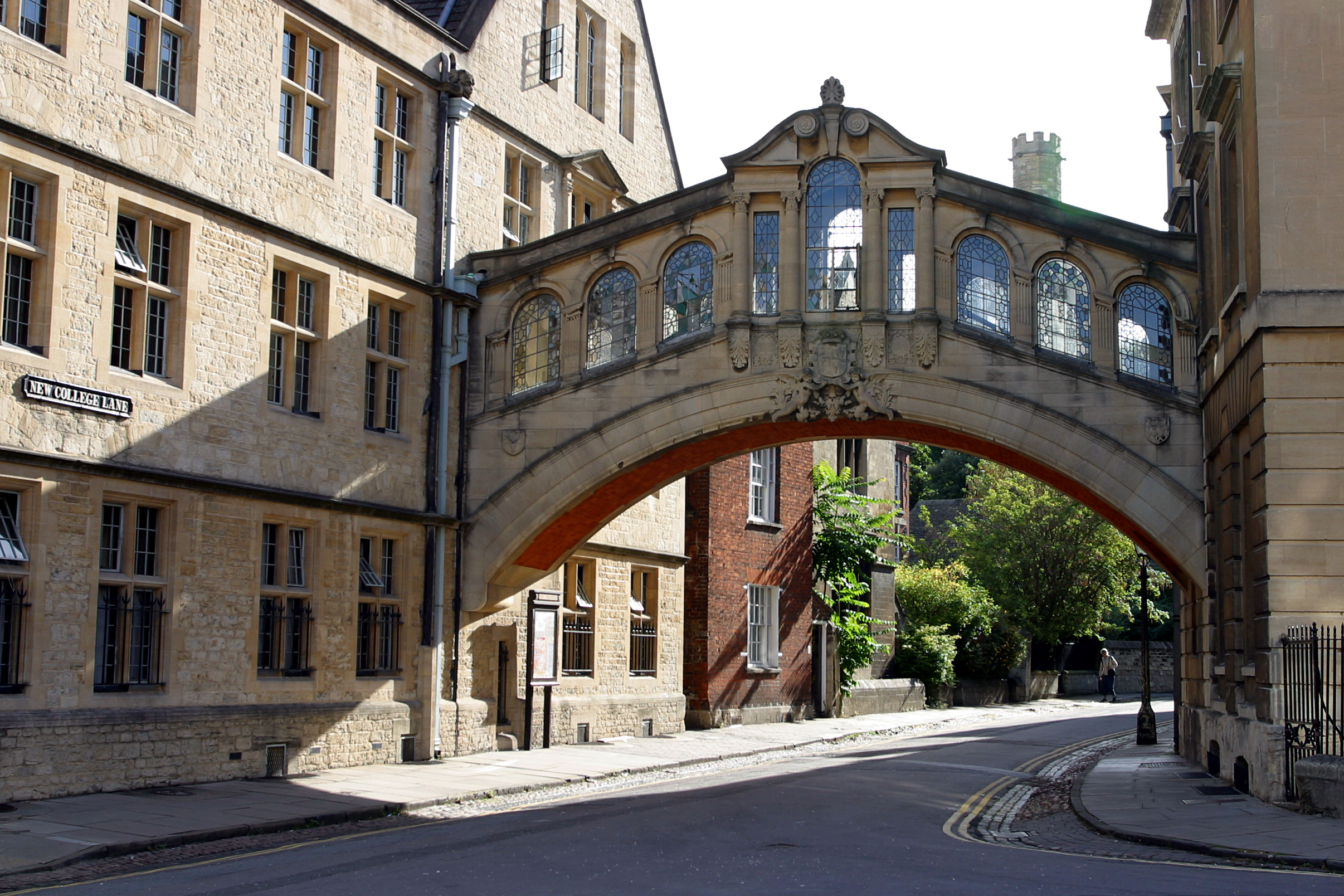
- Venice, Italy, Bridge of Sighs, connects Doge's Palace and prison, 16th century
Environmental factors[]
Besides pedestrian safety and convenience, the chief reasons assigned by urban planners for skywalk development are decrease of traffic congestion, reduction in vehicular air pollution and separation of people from vehicular noise. A number of cities (for example, Spokane, Washington) have given intricate analysis to skywalk systems employing computer models to optimize skywalk layout (Carbon monoxide dispersion analysis in downtown Spokane, ESL Inc., Sunnyvale, (1973))
List of cities with notable systems[]
| This section may require cleanup to meet Wikipedia's quality standards. Please improve this section if you can. (July 2009) |

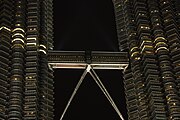
A skybridge connects the two towers of Petronas Towers.


An inside view of the skybridge of Petronas Towers.
| City | Length | Blocks Connected | Link |
|---|---|---|---|
| Atlanta, Georgia | 14 blocks | map | |
| Bangkok, Thailand (between Skytrain Siam Station and Central World) | >2 km | ||
| Calgary, Alberta (+15 or +30 Walkway) | 10 miles (16 km) | ~64 blocks | map |
| Cedar Rapids, Iowa | 15 blocks | map | |
| Cincinnati, Ohio (Skywalk) | 1.3 miles (2.1 km) | 15 blocks | map |
| Dallas, Texas (Skywalks are a part of the larger Dallas Pedestrian Network) | ~12 buildings | map | |
| Des Moines, Iowa (Skywalk) | 4 miles (6.4 km)[4] | 30 blocks | map |
| Detroit, Michigan | 10 Buildings | ~ 8 blocks | map |
| Duluth, Minnesota (Skywalk) | ~17 blocks | map | |
| Edmonton, Alberta (Edmonton Pedway) | ~13 blocks | map | |
| Fargo, North Dakota | |||
| Grand Rapids, MI (Skywalk) | >1 mile (1.7 km) | 7 blocks - connects 12,000-seat VanAndel Arena, JW Marriott, Amway Grand Plaza and Marriott Courtyard hotels as well as 1,000,000 sq ft (93,000 m2) DeVos Place Convention Center | [1] |
| Hong Kong (footbridges) | |||
| Houston, Texas (skyways are a small part of the larger Houston Downtown Tunnel System) | >6 miles including tunnels | ~35 blocks (95 total) | map |
| Kansas City (Crown Center) | |||
| Kuala Lumpur, Malaysia (Petronas Twin Towers) | 170m above the ground and 58 m long | between the two towers on 41st and 42nd floors, world's highest 2-story bridge | |
| London, Barbican Estate and London Wall | map | ||
| Melbourne, Australia | 4 blocks & Airport | 4 city blocks and Tullamarine Airport serviced by a series of skyways | |
| Milwaukee, Wisconsin | Empire building, Chase tower, Grand Avenue mall, Federal building, Hyatt Regency, Hilton, Midwest Airlines center | ||
| Minneapolis, Minnesota (Minneapolis Skyway System) | >8 miles | ~80 blocks | map |
| Mumbai Metropolitan Region, India | 50+ km (planned) | Mumbai Suburban Railway stations to important junctions | MMRDA Skywalks |
| Oklahoma City, Oklahoma | ~30 buildings | ||
| Paradise, Nevada (skyways provided in lieu of street level pedestrian crossings) | |||
| Pittsburgh, Pennsylvania | 16 blocks | map | |
| Rochester, Minnesota (Skyway) | ~17 blocks | map | |
| Rochester, New York | 20 buildings over 13 blocks | map | |
| Saint Paul, Minnesota (Skyway) | >5 miles | 30 blocks | map |
| Sioux City, Iowa | 13 blocks | map | |
| Spokane, Washington | 16 blocks | map | |
| Toronto, Ontario | 0.7 km | 2 blocks - Metro Toronto Convention Centre South Building and Union Station (Toronto) | |
| Vilvoorde, Flanders | 1.6 miles (2.7 km) | 9 blocks | 50°54′50″N 4°24′57″E / 50.91389°N 4.41583°E |
| Winnipeg, Manitoba (Winnipeg Walkway) | 18 blocks | map |
More cities and details: Montgomery, Michael R. and Richard Bean, "Market Failure, government failure, and the private supply of public goods: the case of climate-controlled walkway networks," in Public Choice, Vol. 99 (1999), pages 403-437, whose abstract may be seen at RePEc: Research Papers in Economics.
See also[]
| Wikimedia Commons has media related to skyway that may be added |
| Look up catwalk in Wiktionary, the free dictionary. |
- Footbridge
- Overpass
- Pedestrian separation structure
- Pedway
| |||||||||||||||||||||||||||||
References[]
 |
This page is being imported from Wikipedia, to create a Wikidwelling stub or article. These steps need to be completed:
The original article was at Skyway. The list of authors can be seen in the history for that page. The text of Wikipedia is available under the CC-BY-SA 3.0 license. |